Sharing & Enabling Environmental Data
SEED is a NSW Government repository for enviromental data, much of which is also mapped and can be viewed through the SEED Map Viewer.
There are 5,192 datasets showing as of March 2023 and they can be viewed on the Dataset Catalog. This can also be searched and by inputting ‘RFS’ into the seach box and sorting by relevance some interesting datasets appear. We’ll look at a couple:
NPWS Fire History – Wildfires and Prescribed Burns
You need to click on the different layers to bring up an outline of the fire and a description.
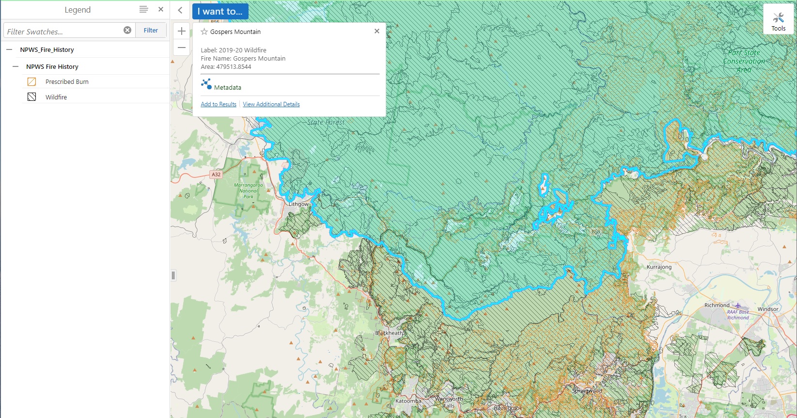
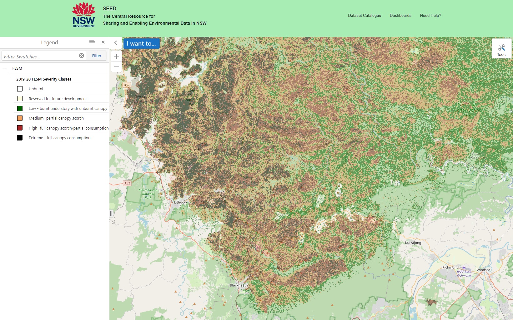
Fire Extent and Severity Mapping has been completed for every year since 2016/17. The version for 2019/20 shows the extent of the damage caused by Gospers Mountain Fire:
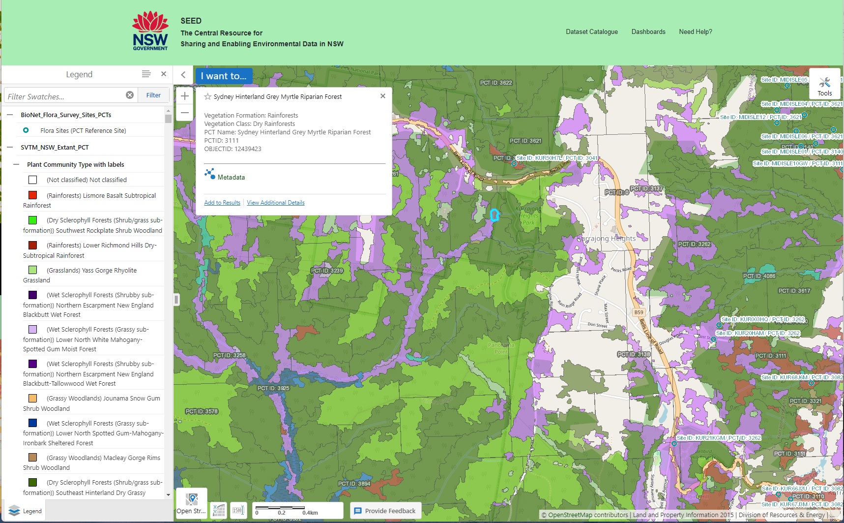
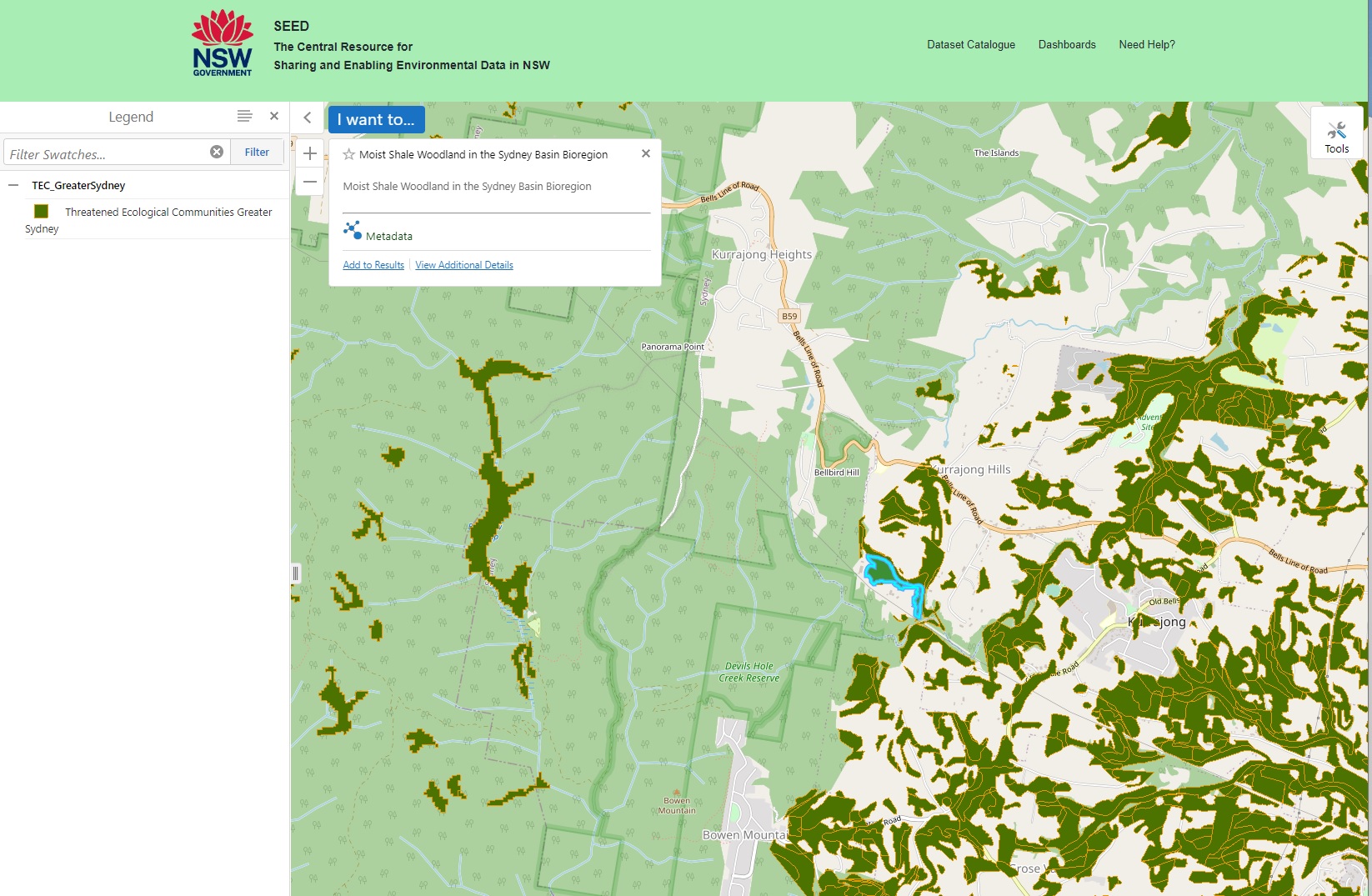
Threatened Ecological Communities in the Sydney Basin maps a signifcant portion of all land in the Sydney basin:
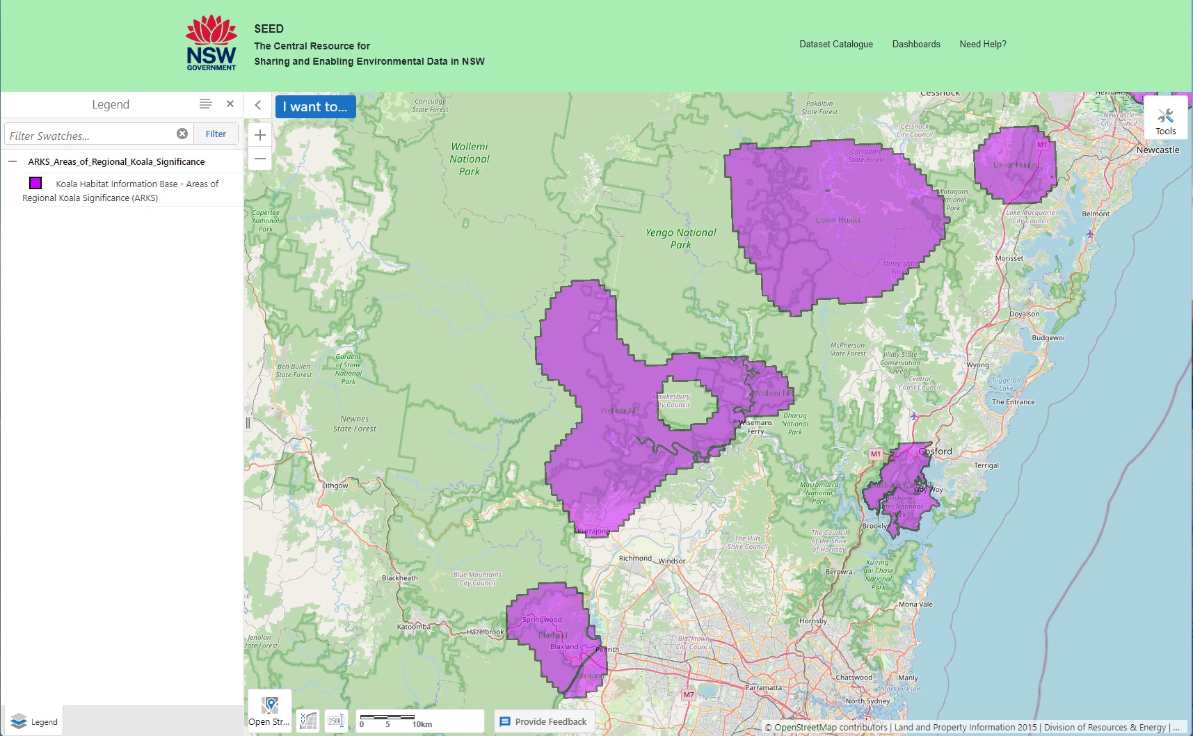
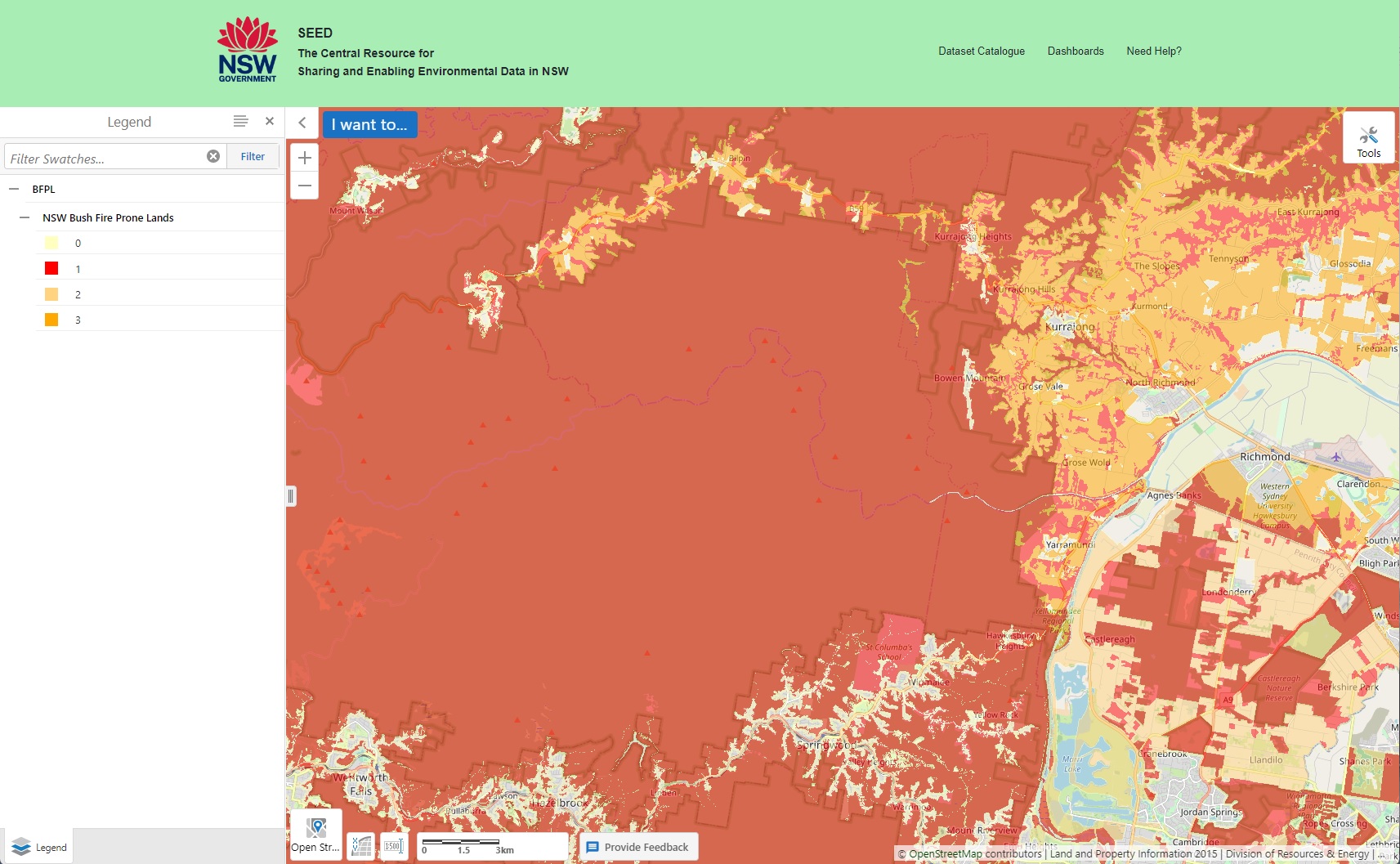
Bushfire Prone Land surrounds us at Kurrajong Heights:
BioNet Flora Survey Sites. This collection is a central, authoritative database for systematic vegetation survey data in NSW. Among other applications, this plot data is used to construct and maintain the quantitative Plant Community Type classification & Vegetation Integrity Benchmarks held in the BioNet Vegetation Classification Data Collection. These plots are also used to construct and update State Vegetation Type Maps held in the BioNet Vegetation Map Data Collection.