A significant change to our Fire Management
At a superficial level it would be easy to dismiss the new Australian Fire Danger Rating System as a simplified version of the old 6 level warning system.
But there is much more behind the system and the better you understand it, the better your informed decision making will be.
But when all is said and done the big decision we all have to make is whether to stay and defend or go, and some of the factors are:
- How well have you prepared your place?
- Is there a clear escape route? **
- Can you shelter in place?
- If you can, are you properly equipped to ‘mop up’ after the fire has passed?
Its best to consider all these things and write them in to your Bush Fire Plan. Don’t try to make decisions at the last minute!
** Note: A lot of people die by leaving too late
OK .. so lets look at the new system:
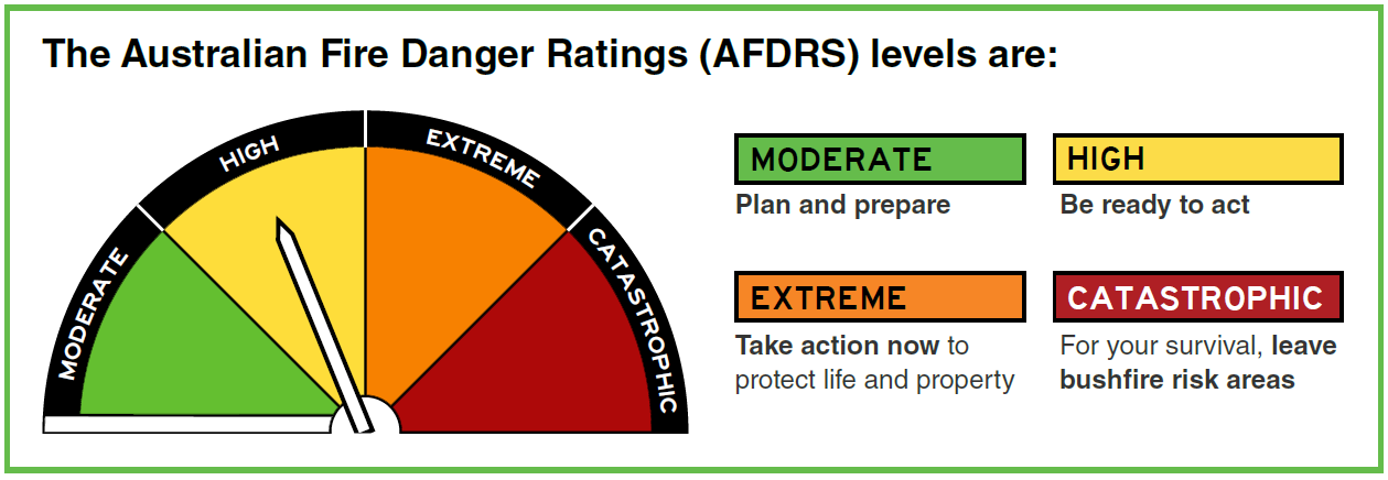
The system has been implemented nationally so for the first time all states are using a common approach.
It has a number of components:
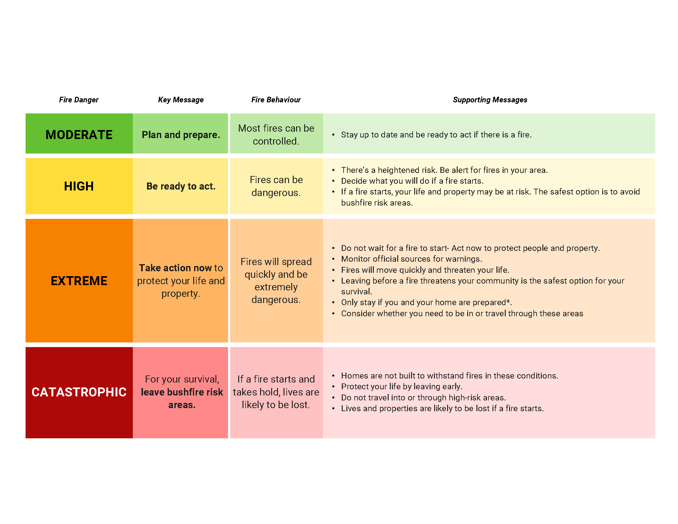
Community Information – The System Explained

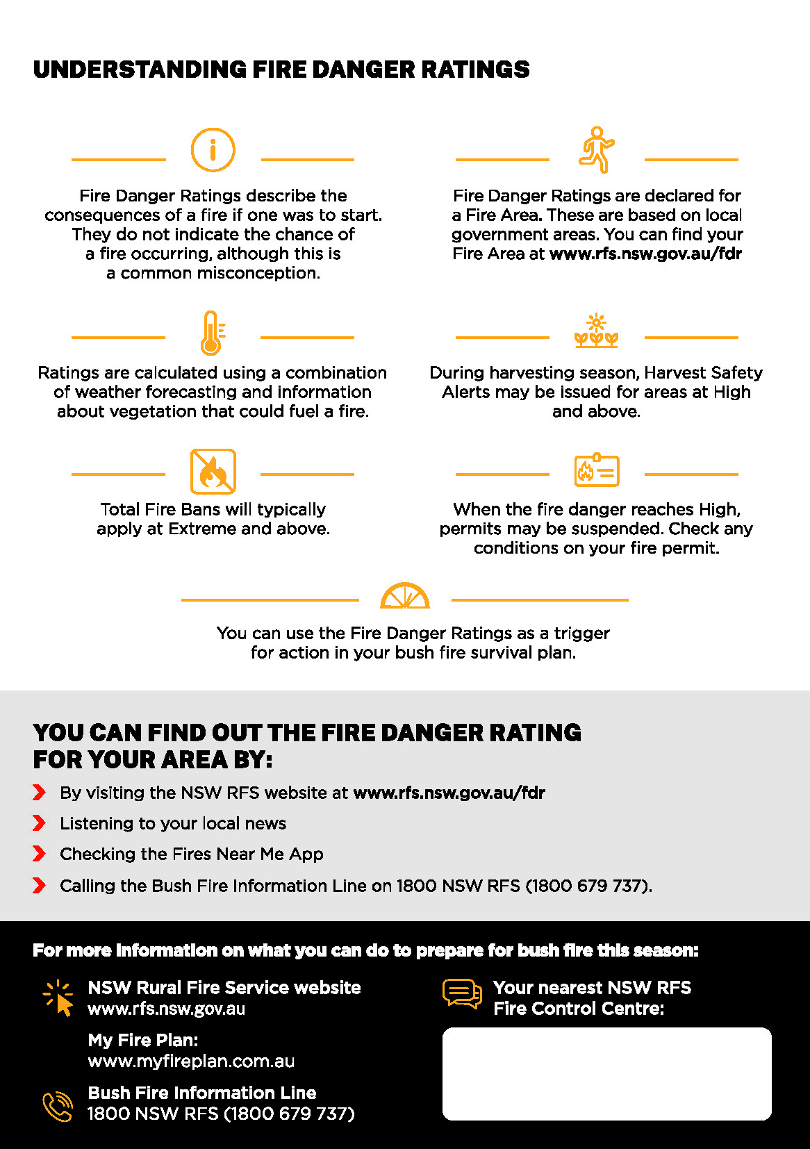
You might like to print out this image which summarises what you should do under different conditions:
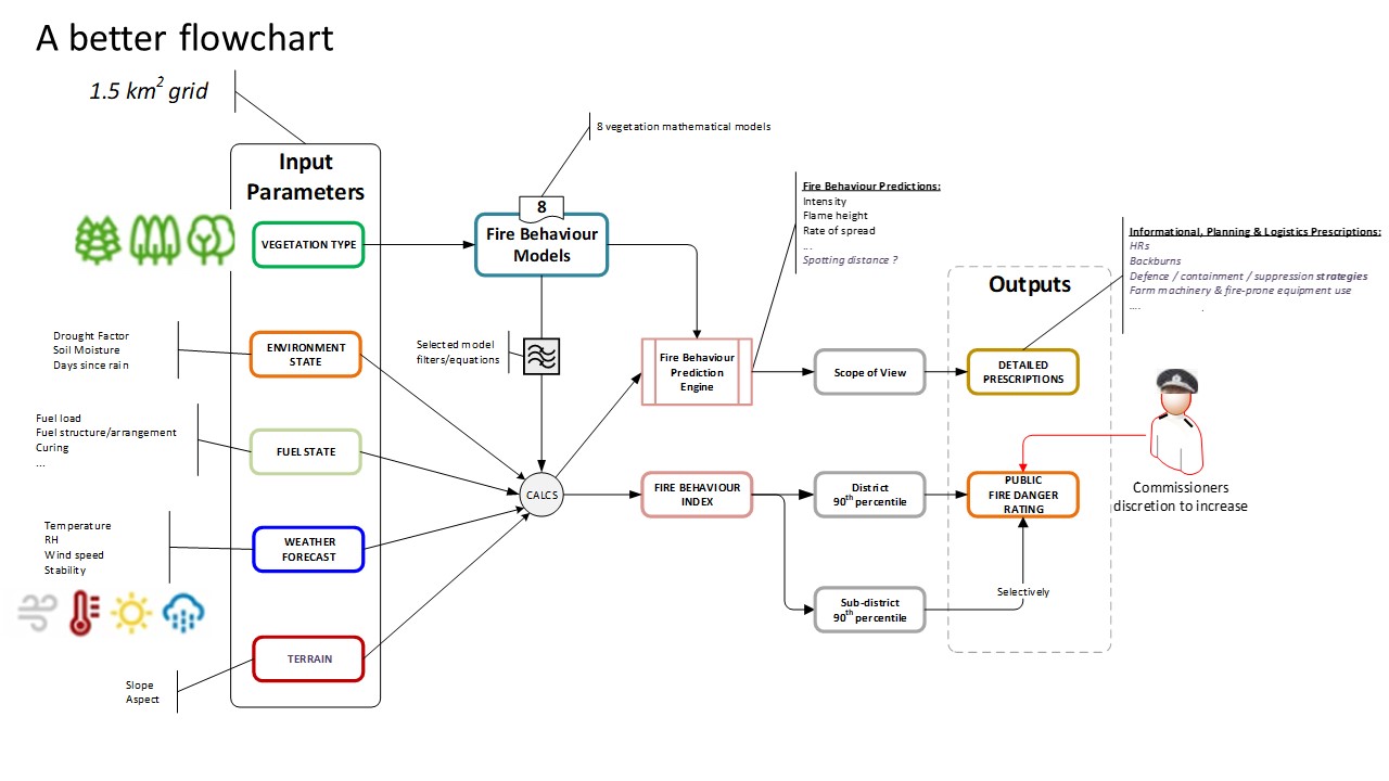
An Overview
The old system was simply based on weather input whereas the new system takes inout from multiple inputs including vegetation, the state of the environment including moisture content, the fuel state, and the terrain as well as the weather. We have prepared this oveview to better explain how it all works:
Understanding the Fire Behaviour Index
This quick guide provides further information for the Forest environment which comprises the bulk of the vegetation around Kurrajong Heights:
Weather Information
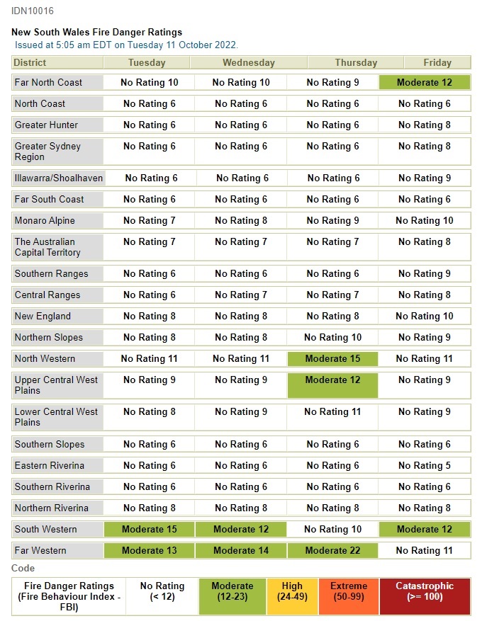
The Bureau of Meterology plays a big part in helping the RFS and in the fire season embeds its people at Homebush as part of its service.
It publishes a Fire Danger Rating for each district. This is what the NSW one looks like:
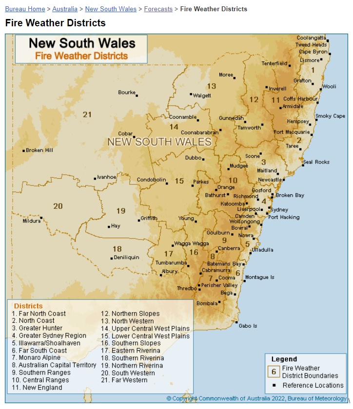
Please note that the Fire Weather Districts differ from the Weather Forecast Districts. This map shows the former and Kurrajong Heights is in the Greater Sydney region #4. However as most of our fires come from the Central region #10 we should also monitor that.
We are in the Central Tablelands District for Weather Forecasting.
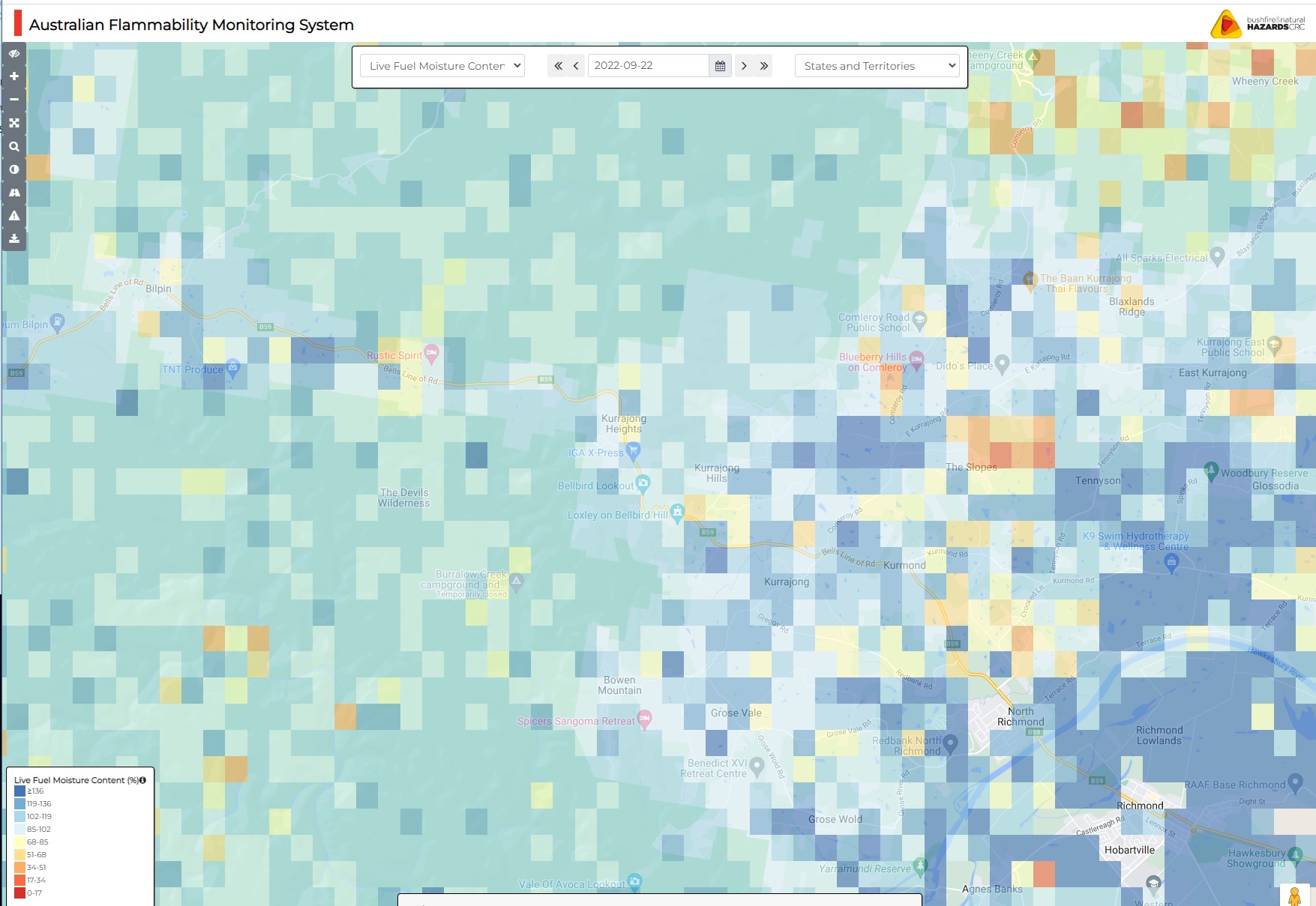
Australian Flammability Monitoring System
This system measures the Live Fuel Moisture Content . The website also provides historical information and helps provide an excellent understanding of the moisture in the ground.