Water is the Firies Friend!
The more water that is on hand the better you and we can protect your home.
When a RFS crew is dispatched to a fire or is tasked with doing property protection in a bush fire, the first question to be answered is “What water is there and how can we access it.”
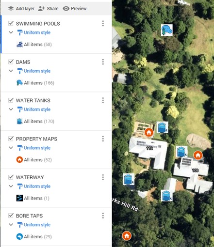
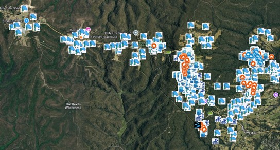
So we have taken all the water information that we can find, and particularly the Property Map information, and created a water map of the Kurrajong Heights Brigade district.
The map is created in Google MyMaps and can be updated by our Coordinators. It can then be exported to a KMZ mapping file and can be imported into the RFS Firemapper program.
Firemapper is a live mapping program that shows the presence of all trucks and radios on a fireground in real time. It is installed on the Mobile Data Terminal in all RFS Fire Trucks and most volunteers have it installed on their mobile phones.
In the top picture below the water mapping for two properties is shown and in the bottom picture the current map for our Brigade area is shown.