Other Information & Links
This page covers some interesting information sites with a focus on fire.
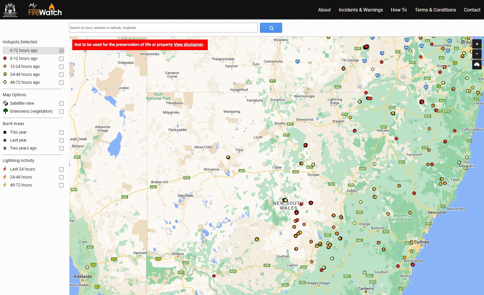
My Firewatch maps hotspots derived from satellite data. It looks to take a minimum of 30 minutes after a satellite pass for the data to appear on the map. The satellites pass every few hours. The data cannot therefore be used to determine real time conditions, but it often provides information on the location of a fire well before Fires Near Me, the COP etc
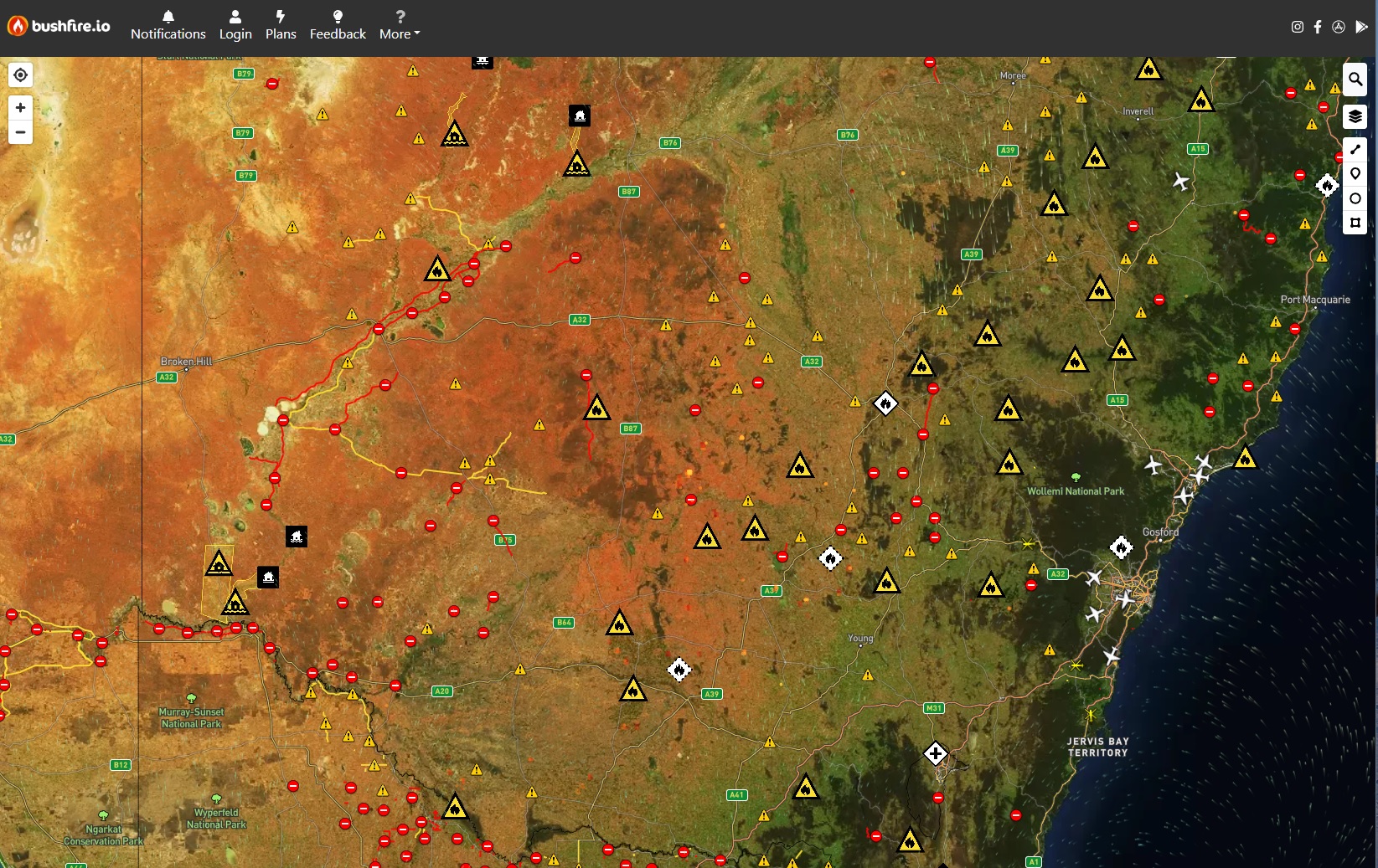
Bushfire.io accumulates data from a number of different sources and combines all this data to one map. Included are bushfires, road and traffic information, wind direction and speed, floods and emergency services aircraft.